Hueco Tanks, TX
In 1998, Rupestrian CyberServices was contracted to map and photograph "approximately 50 sites" in a few weeks for the planning process. Using precision GPS, we mapped, and photographed 188 sites. For this project, we developed the now widely used techniques of digital image enhancement. We provided an ArcView GIS, site database, and an image database. We made extensive use of annotated panoramas to identify site locations.
http://www.tpwd.state.tx.us/spdest/findadest/parks/hueco_tanks/
http://www.texasbeyondhistory.net/hueco/rockart.html
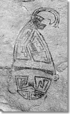
See examples of image enhancement from Hueco Tanks.
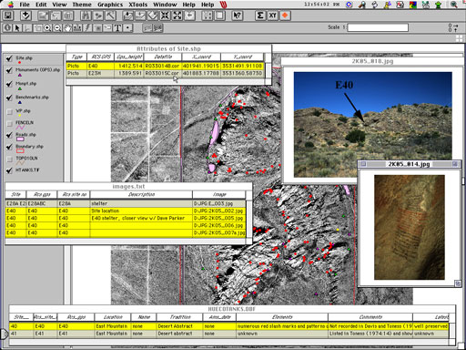
Image Database
Site (panel) Database
Mapped 188 sites, and
created ArcView GIS Database.

Hueco Tanks field work. Rupestrian CyberServices crew photographing rock imagery site E34D; Robert Mark (center), assisted by Margaret Berrier (left) and David Parker (right).
Mouse over for enhancement.
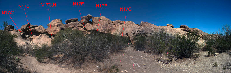
Stitched panorama with arrows locating sites (panels).
RCS: Computer science in the service of rock art research, protection, and education.